
This paper discusses architecture, functionalities, and transformative impact on GIS applications of the Geospatial Analytics Extension for KNIME (GAEK). GAEK is an innovative fusion of visual programming and geospatial analytics, designed to simplify and amplify GIS endeavors. This groundbreaking extension seamlessly integrates visual programming with advanced geospatial analysis, making complex spatial tasks more accessible than ever. Empowering users from spatial analysis novices to seasoned researchers with a visual interface, revolutionizing the approach to GIS tasks.
Read more here.
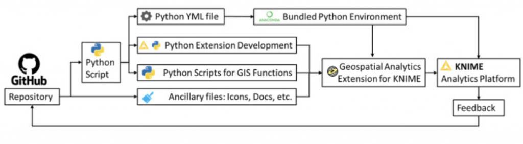
The development framework of Geospatial Analytics Extension.
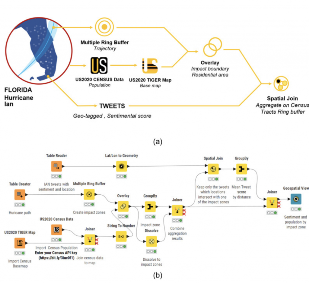
The workflow for discussed case study example (a) Conceptual flow chart and (b) KNIME workflow