
This paper highlights the importance of travel time estimation, especially in geospatial studies related to healthcare accessibility. The study, conducted in the United States, compares six different methods (Google Maps API, Bing Maps API, Esri Routing Web Service, ArcGIS Pro Desktop, OpenStreetMap NetworkX, Open-Source Routing Machine) for drive time estimation with a focus on cost, accuracy, and scalability. The research involves a case study that calculates driving times for 10,000 origin-destination (OD) pairs, specifically between ZIP code population centroids and pediatric hospitals across the country. For more information READ.
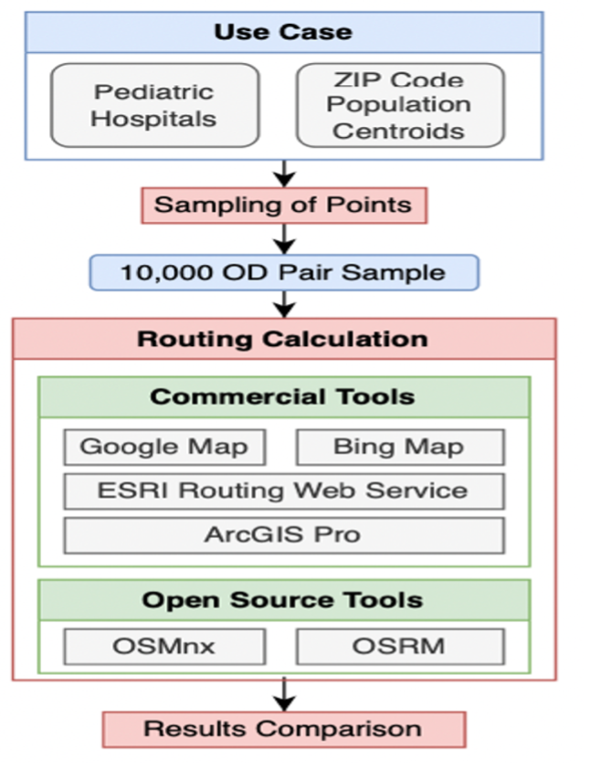
Framework of researchers comparative analysis.