Discussions:
Q1. (Wendy Guan) Where does ‘geography’ fit in the big data and technology future?
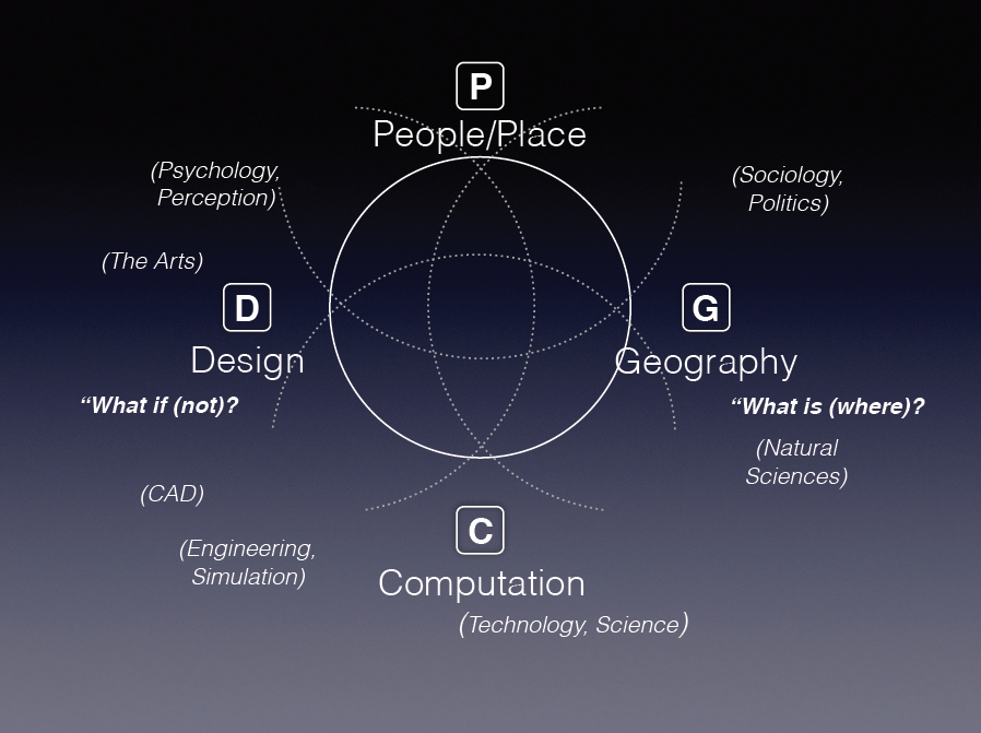
A1. (Ben Lewis) GeoDesign. Need to find other ways to harness the unique contribution of geography.
(John Lieberman) Why is so hard for mainstream IT to adopt geographic aspects, e.g. lat and lon?
(Chaowei Yang) Are there going to be GIS in the next ten years given main stream IT is taking over almost everything? But mainstream IT is having more geospatial aspects in their research and development.
(May Yuan) 30 years debate between geography and computer science. IT has really advanced GIS, GPS and mapping. They recognize the importance of maps and they still develop useful tools. Is spatial really special?
(Josh Lieberman) They do that by avoiding spatial. Google Maps does not have spatial functions, instead they compute based on a graph, not a full function map. May spatial is just really hard.
(Wendy Guan) Scholars come to us for an easy access to a geographic knowledge. One hand we are picking up every possible new technologies, and then we are forgetting important geographic questions. Our system is not providing so much of geographic knowledge.
(May Yuan) Maybe develop procedure knowledge for GIS and embed them in GIS software. In GIS, we do not have many fundamental knowledge set, instead we have solutions and operations. What are the counterparts in GIS compared to fundamental science? Knowledge production…
(Wendy Guan) Solving types of problems not one problem…
Q2. (Zhenlong Li) There are other departments teaching GIS courses. Do we need to take a lead?
A1. (Josh) This is more of a political question in a interdisciplinary field…
Q3. (Yun Zhang) GIS is more dependent on computer science and technology. Knowledge Procedure. Can we provide more than tools, but more geographic knowledge?
A3. (Sudhir) At ESRI, we hire computer science graduates, but we have them work in an interdisciplinary atmosphere. We bring them into a real-world solution in collaboration with diverse group of people.